
Gwanaksan Mountain 관악산
-
Free
Beginner (to Intermediate) Hiking Courses Starting from Seoul National University/Gwanaksan Park or Gwacheon:
-
Seoul National Univ. Station (line 2, exit 3). Walk 45m ahead and take Bus #5513 (14 mins, 11th stop) or Bus #5511 (18 mins, 13th stop) and alight at 'Construction Environment Research Institute 건설환경종합연구소'.
-
Seoul National Univ. Station (line 2, exit 3). Walk 45m ahead and take Bus #5513 to 'Seoul National University 서울대학교' (7 mins, 4th stop). 20 mins walk via Gwanaksan Park Entrance to trail near Construction Environment Research Institute.
-
Gwanaksan (Seoul National univ.) Station (Sillim Line, exit 1). Walk 50m ahead to Gwanaksan Park Entrance.
-
Government Complex Gwacheon Station 정부과천청사역 (line 4, exit 10/11) or Gwacheon Station 과천역 (line 4, exit 7), 10 mins walk.
Intermediate to Advanced Hiking Courses (info only):
-
Sadang Station (line 2, exit 6)
-
Nakseongdae Station (line 2, exit 1)
Seoul: www.gwanak.go.kr (Gwanak-gu), www.geumcheon.go.kr (Geumcheon-gu)
Gyeonggi-do: www.gccity.go.kr (Gwacheon-si), www.anyang.go.kr (Anyang-si)
A Mountain Popular with Beginner & Seasoned Hikers
Gwanaksan Mountain, located south of Han River has many hiking courses from the more advanced exposed rocks terrain with spectacular mountain range view; or through the safety of forest valley and stream with rare view of a temple on cliff edge.
Added to its popularity as a mountain hiking destination with the locals, Gwanaksan Mountain is easily accessible from several subway stations and covers a section of the well-known Seoul Trail course and the easy Gwanaksan Valley Nadeulgil Trail (3.2km from Gwanaksan Park Entrance to Samngeori Mineral Spring) as well.


Gwanaksan Mountain across Seoul & Gyeonggi-do Province
Gwanaksan Mountain (629m) sits on the border between Gwanak and Geumcheon districts of SEOUL; and Anyang and Gwacheon cities of GYEONGGI-DO province.
Due to its geographic location, Mt. Gwanaksan is 'shared' across multiple administrative divisions with each covering tourism information on sections of the mountain under their own administration.
Information Signage in Korean
The direction and information signs at Gwanaksan Mountain are fairly different from other mountains (e.g. Bukhansan, Inwangsan) under Seoul's Administration.
Gwanaksan's direction signs used to be primarily in Korean, but in recent years, it has included English on the more popular trails, making the mountain more accessible to foreign travellers in Seoul. However, you may still come across information signs in Korean only and no map information of your current location.
Nevertheless, with its diversity and unique charm, Gwanaksan Mountain has been popular with the locals for ages and its summit can get pretty crowded with hikers especially on weekends.


Gwanaksan's Main Trail Entrances, Estimated Hiking Times & New Sillim Line (Subway)
Generally, there are 3 main starting points for the hiking courses from:
-
Seoul National University: Northwest of Gwanaksan Mountain, Easy to Intermediate.
-
Government Complex Gwacheon Station / Gwacheon Station: East of Gwanaksan Mountain, Easy to Intermediate
-
Sadang Station / Nakseongdae Station: North of Gwanaksan Mountain, Intermediate to Advanced.
There are numerous interlinked hiking courses, from easy to advanced up the mountain peak and around the mountain. There are also hiking trails connected to another mountain, Samseongsan Mountain via Palbong Ridge.
A one-way course from Seoul National University / Gwacheon takes about 2 hrs to the summit; and from Sadang, about 2.5 - 3 hrs.


Gwanaksan's Intermediate & Advanced Hiking Courses
The intermediate-advanced hiking trails (esp. from Sadang Station) up Gwanaksan Mountain are enormously stunning on its unique rock formations, breathtaking views of Seoul and the exhilarating challenge of getting up the steep mountain on ropes and chains in some sections.


Over the years, high and steep stairways were constructed to make this popular mountain safer for hikers and at the same time, more people can visit as well.


Gwanaksan for First Timers or Beginners
Gwanaksan Mountain, compared to other mountains in Seoul, might be a more 'complex' and rocky mountain for the inexperience foreign travellers to Seoul.
There are numerous hiking trails, merging and diverging with information signs at times, in Korean only. Even Google Translate on the Korean signage may not give clue to the direction to take as well. A wrong or missed turn may lead you to the advanced trails with exposed rocks and difficult terrain that may require holding on to ropes or chains for the steep ascend/descend.

💡Guidelines for Beginner Hikers New to Gwanaksan Mountain:
-
Plan your course in advance.
-
Stay on your planned course.
-
Do not deviate from your planned course unless you know where you are heading or with a local familiar with the mountain.
-
Take note of the places you will be visiting on your hiking course, including their names in Korean for the direction signs on the trail.
-
Of course, the hiking basics of bringing enough drinking water, snacks/food; buffering sufficient time for your return trip or descend; wearing proper footwear and clothing still apply. Also, pre-installed with these useful mobile apps, Naver Map, KakaoMap and Google Translate.
Following the above guidelines would ensure a safer, fun and memorable hiking experience at Gwanaksan Mountain.

Cherry Blossoms & Spring Flowers at Gwanaksan Mountain
In Spring, there are more chances to catch cherry blossoms or spring flowers at the base or entrance of Gwanaksan Mountain than on the trails.


Autumn Foliage at Gwanaksan Mountain
Autumn is another popular season to visit Gwanaksan Mountain when the autumn foliage coloured the mountain range in spectacular shades of yellow, orange and red.


Winter at Gwanaksan Mountain
Winter is beautiful at Gwanaksan Mountain when the snow covered the mountain in white. Care must be taken with proper footgear when hiking the mountain in winter.


Recommended Course: From Seoul National University to Gwacheon (EASY COURSE), 2 hrs to Summit
On this recommended beginner course, you can enjoy walking through the forest valley, cool dip at the stream, visit a Yeonjuam Temple near the mountain top and take photos of Yeonjudae Temple on cliff edge from the observatory.
💡The reverse course from Gwacheon to Seoul National University is perfectly fine as well. Ending the hike at Gwacheon will lead you to few nice restaurants with water view and within walking distance to subway stations. Ending the hike at Seoul National University leads you to a leisure stroll at Gwanaksan Park with some eateries near the park's entrance and Gwanaksan (Seoul National univ.) Station (Sillim Line, Exit 1) just ahead. Alternatively, you may start and end your hike at the same point (e.g. Gwanaksan Station).
Course Highlights & Common Names on Trail Signs:
-
(optional) Starting from Gwanaksan (Seoul National Univ.) Station (Sillim Line, Exit 1), via Gwanaksan Park 관악산공원
-
Trail Entrance: Construction Environment Research Institute 건설환경종합연구소, Seoul National University 서울대학교
-
📷(optional) Gwanaksan Meteorological Radar Observation Station in the background
-
📷Observatory for view of Yeonjudae Hermitage 연주대 on cliff edge
-
📷Yeonjudae Summit 연주대 (629m)
-
📷(optional) Gwanaksan Meteorological Radar Observation Station 관악산 기상 레이더 관측
-
📷(optional) Yeonjudae Hermitage 연주대
-
📷Yeonjuam Temple 연주암
-
Gwacheon Hyanggyo Confucian School 과천향교
-
Government Complex Gwacheon Station 정부과천청사역 / Gwacheon Station 과천역
💡The English signage on the trail may refer Gwanaksan Mountain's Summit as 'Yeonjudae (Summit)', 'Yeonjudae Peak' and 'Yeonjudae (Rock)' with the Korean signage remains consistent as '연주대'.
💡The same goes for Yeonjuam Temple as 'Yeonjuam', 'Yeonjuam (Temple)' and 'Yeonjuam Hermitage'. They all refer to the same place as its Korean signage '연주암'.

Detailed ASCEND Course Guide to Summit:
(OPTIONAL) Starting from Gwanaksan (Seoul National Univ.) Station (Sillim Line, Exit 1)
With the opening of the new Sillim Line (subway) on 28 May 2022, Gwanaksan (Seoul National Univ.) Station (exit 1) located just outside Gwanaksan Park Entrance/Seoul National University Entrance has become a popular option for many hikers to Gwanaksan Mountain.
Once you exited from the station, you will see Gwanaksan Park Entrance about 50m ahead. You can easily follow the signs to Yeonjudae (summit). The trail will merge near Construction Environment Research Institute about 20 mins into the hike.
Sights along the way:


1. Take Bus from Seoul National Univ. Station to Construction Environment Research Institute @ Seoul National University (Trail Entrance)
From Seoul National Univ. Station (line 2, exit 3), take Bus #5513 (14 mins, 11th stop) or Bus #5511 (18 mins, 13th stop), enter Seoul National University's main gate and alight at 'Construction Environment Research Institute Front 건설환경종합연구소앞'.
💡For those who wish to conserve their energy, this is the shorter hiking route compared to starting from Gwanaksan Station (Sillim Line, Exit 1).


💡If you are returning to the same place after your hike, please note that 'Construction Environment Research Institute Front' bus stop is for DROP OFF only.
To take bus #5513/5511 back to Seoul National Univ. Station, walk uphill around the loop road to 'The 2 Engineering Building' bus stop, about 300m away.
2. Enter the Trail Entrance
Upon alighting from the bus, turn RIGHT and walk downhill 15m from the bus stop to the trail entrance on your LEFT. Go up the stairs.
🔀At the top of the stairs, turn LEFT at the fork road.


3. Cross the Stream
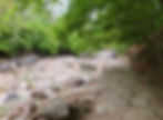
🔀At the next important fork road, turn RIGHT and cross the stream below.
💡Take note of this important fork road as there is no sign in placed yet. The other trail on the LEFT leads to a rocky terrain with limited signage (esp. English) and proper hiking gears required. It has very gorgeous view of the mountain range and unique rock formations. The last section up Yeonjudae Summit on ropes is certainly not for those who are afraid of heights.
💡If you are returning to Seoul National University, take note of the signs this junction.
-
The sign to 'Seoul National University' leads to Construction Environment Research Institute (i.e. the trail entrance).
-
The sign to '4th Rest Area' leads to Gwanaksan Park (worth a visit!) and Seoul National University's main gate. To get to Seoul National Univ. Station, cross the road in front of the main gate to the bus stop along the main road and take bus #5511/5513/5515/5528 (10 mins) or hop on the newly open Gwanaksan Station (Sillim Line, Exit 1), located just outside Gwanaksan Park Entrance/Exit.


4. Walk Along the Stream
🔀Shortly, at the next fork road, keep LEFT, following the sign to 'Yeonjudae Summit'.
Enjoy the forest valley as the next fork road is quite a distance away, near to the summit.
💡The trail on the RIGHT leads to Hakbawineungseon Ridge, a rough terrain with limited signage (esp. English) but with scenic view of mountain range, interesting rock formations and the use of ropes to ascend in some sections.


5. Hiking in the Forest Valley
Hiking under the shade of the forest and up two long stairways towards the summit. There is not much mountainous view in this section of the hiking course.


6. Cross Junction to Jeonjudae Summit
After coming up from the stairs (black-coloured), you will reach this important cross junction to Yeonjudae Summit. Many trails past through this junction.
💡Stairway (black) that you came up from leads to 'Seoul National University (Engineering Hall) 서울대(공학관)'. If you wish to go back to Seoul National University after going to Yeonjudae Summit and Yeonjuam Temple, you will need to come back to this cross junction and go down this stairway (black).
💡OPPOSITE is the stairway (brown) going down to 'Yeonjuam Temple 연주암'.
💡LEFT of the stairway (black) is the direction to 'Yeonjudae (Rock) 연주대' (i.e. summit).
💡RIGHT of the stairway (black) is the direction to 'Sammaksa Temple 삼익사' at another mountain, Mt. Samseongsan (446m).


Photo Hotspot: Gwanaksan Meteorological Radar Observation Station & KBS Transmission Station (OPTIONAL)
🔀Turn LEFT at the top of the staircase (black) leading up to 'Yeonjudae (Rock) 연주대'. Take the classic photo shot🤳 with the Gwanaksan Meteorological Radar Observatory (i.e. big golf ball looking building) on the background at a safe and comfortable distance. Walk back to the cross junction.
💡The rocky trail towards Gwanaksan Meteorological Radar Observatory leads to Yeonjudae Summit as well but it is a more dangerous (but popular) trail and not for those who are scared of heights.


7. Walk to Heliport
🔀For an easier and safer path to Yeonjudae Summit, take the dirt path LEFT of the brown stairway towards the heliport.


8. Hike to Observatory for View of Yeonjudae on Cliff Edge
🔀Walk across the heliport for the trail going down. At the fork road, turn LEFT at the sign towards 'Yeonjudae Peak 연주대' and walk up the stairs for the observatory, mid-way to Yeonjudae Summit.


9. Observatory of Yeonjudae on Cliff Edge
The observatory will be on your right, another favourite photo hotspot🤳 for Yeonjudae Hermitage on the cliff edge and panoramic view of Seoul.
💡From the observatory's viewpoint, the stone monument on top of Gwanaksan Mountain is on the left of Yeonjudae Hermitage.


10. Gwanaksan Mountain - Yeonjudae Summit (Attitude of 629m)
Continue on the ascend after the observatory stop will lead you to the peak of Gwanaksan Mountain, Yeonjudae Summit at 629m.
Celebrate your achievement in reaching the top of Gwanaksan Mountain with a memorable photo shot🤳 next to the popular stone monument, engraved in big Chinese characters 冠岳山.
💡There are various trails going down from the summit, including those that require holding onto ropes. Unless you know what you are getting into, if not, go down on the same safe trail that you have come up earlier.


From the summit, you can head to these two places before your descend:
a. Gwanaksan Meteorological Radar Observation Station 관악산기상레이더관측소 (OPTIONAL)
Opening Hours:10.00-16.30 daily / Lunch Break: 12:00-13:00 / Free Admission
The big golf ball looking Weather Radar Observatory is located 634m above sea level on top of Gwanaksan Mountain with cable car access for staff only.
The meteorological observatory was opened to the public on 23 June 2009. Visitors can observe meteorological equipment and exhibits installed at the observatory.


b. Yeonjudae Hermitage 연주대 (OPTIONAL)
Located behind the summit stone monument is the Yeonjudae Hermitage on the edge of the cliff.
💡Care should be taken when taking the deep and narrow trail down to Yeonjudae Hermitage. Again, it is not for those who are scared of heights.


Detailed Summit DESCEND Course Guide to Gwacheon:
1. Descend from Yeonjudae Summit
Walk down from the summit on the SAME trail up earlier and hike past the observatory as well.
🔀At the same fork road passed by earlier, continue your descend, following the sign towards 'Yeonjuam Hermitage 연주암'.
💡If you would like to head back to Seoul National University instead, follow the sign, 'To Anyang 안양방향' back to the heliport and go down the stairway (black) at the cross junction.


2. Yeonjuam Temple 연주암
There are quite a number of buildings at Yeonjuam Temple.
Often, hikers can be seen taking a break or have their snacks/lunch at the temple's ground. There are scenic lookouts from the temple too.
💡If you would like to go back to Seoul National University after visiting Yeonjuam Temple, look out for the stairway (brown) around the temple with sign '서울대' (Seoul National University) leading up back to the cross junction. Alternatively, you can walk back to the fork road on your way down to Yeonjuam Temple to get back to the heliport and cross junction. From the cross junction, you can take the stairway (black) down to Seoul National University.


3. Hiking down to Gwacheon
The trail down towards Gwacheon is relatively easy with gentle slope, passing bridges across the stream before reaching the base of the mountain.
Take a moment to enjoy the beauty and sound of the forest valley.☘


4. Along the path towards subway station
🔀Upon reaching the base of the mountain, turn LEFT and walk along the path towards Gwacheon Hyanggyo Confucian School and onward to the nearby subway station (Government Complex Gwacheon Station / Gwacheon Station).
Enjoy the colourful potted plants, golden statue, amusing art works and the clear stream along the way.


5. Restaurants
Why not have some delicious Korean food and rice wine (makgeolli) at one of the restaurants along the stream with water view?🍜🍺


6. Gwacheon Hyanggyo Confucian School 과천향교
🔀Turn RIGHT to walk across the bridge directly in front of the school's gate. Walk towards the main road, Gwanaksan-gil and turn RIGHT.


7. Walk to Government Complex Gwacheon Station 정부과천청사역 (line 4)
🔀Walk along the main road, Gwanaksan-gil and turn LEFT at the blue sign, 'Gyodong-gil'. Walk along the path and straight through the underpass ahead.
🔀When coming out from the underpass, turn RIGHT and walk towards Government Complex Gwacheon Station (line 4, exit 11), about 170m away.


Which mountain to hike next?
Map of Bus Route from Seoul National Univ. Station (Line 2, Exit 3) to Construction Environment Research Institute @ Seoul National University (Hiking Trail Entrance)
%20to%20Construction%20Env.jpg)
Map of Walking Route from Gwacheon Hyanggyo (Hiking Trail Exit) to Government Complex Gwacheon Station (exit 11)

KoreaToDo TOP PICKS - Tours, Activities & Discount Tickets
➥ Handpicked experiences by KoreaToDo for their uniqueness, value, popularity, price competitiveness and at times, tedious to reach by public transport.


♔ KoreaToDo recommends Klook.com, Asia leading in-destination service provider.

🌸SEASONAL HOT PICKS🌸 Handpicked Experiences from Seoul


Other KoreaToDo Collection that you may like:
-
Cheonggyesan Mountain (582.5m) - A mountain near to Gwanaksan but with easier hiking course.
-
Bukhansan National Park - The most visited national park in Korea.
-
Ansan Jarak-gil Trail / Ansan Mountain (296m) - 7km raised wooden deck trail surrounded the mountain with options to Ansan Mountain Peak or cross over to Inwangwan Mountain.