
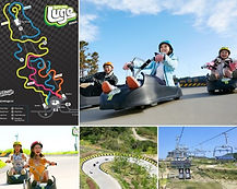
Oryukdo & Igidae Attractions: Oryukdo Skywalk, Oryukdo Sunrise Park & Igidae Coastal Trail
-
Free to visit
-
Kyungsung Univ. Pukyong Nat'l Univ. Station (line 2, exit 5). U-turn, walk along the curve of pedestrian walk and go straight 100m. Take bus# 24, 27 or 131, 18 mins ride OR bus# Nam-gu 2, 27 mins ride.
-
Busan Station (line 1, exit 6). Turn right upon exit. At the traffic light next to the subway's exit, cross to the middle of the road and turn right for the bus stop. 2 mins walk. Take bus# 27. 47 mins ride.
Get off at Oryukdo Skywalk 오륙도 스카이워크 stop. Walk 120m towards Haeparang-gil Tourist Information Center directly in front. 1 min walk. This is the base to Oryukdo Skywalk, Oryukdo Sunrise Park & Igidae Coastal Trail.
The scenic Oryukdo and Igidae coasts of Namgu district in Busan comprise of volcanic rocks and tuffaceous sedimentary rocks made about 80 million years ago. They are recognised as geological sites (geosites) of Busan National Geopark.
💡National Geoparks of Korea are geo-scientifically important areas with outstanding natural beauty, certified by the Minister of Environment to preserve for its educational and tourism values.
This is also the place where 2 famous cross-province trails, Namparang Trail and Haeparang Trail come together, including the popular Busan Galmaet-gil Trails.


As such, it it definitely worthwhile to spend some time to explore, experience and immerse in the natural beauty of Oryukdo and Igidae while in Busan.


Oryukdo-Igidae Route Overview & Orientation
Haeparang-gil Tourist Information Center ♦ Haeparang Cafe ♦ Orykudo Observatory (Rooftop)
Oryukdo-Igidae Route Overview
This guide will cover the route based on arrival at Haeparang-gil Tourist Information Center to explore the surrounding areas from Oryukdo Quay to the famous Oryukdo Skywalk and Oryukdo Islands, followed by Oryukdo Sunrise Park, Igidae Coastal Trail and complete the hike near Yongho Starlight Park in about 2.5hrs.

Starting Point & Orientation
Once you get off the bus, you will see Haeparang-gil Tourist Information Center building right in front. On the RIGHT of the building (facing the sea) is Oryukdo Quay, Oryukdo Islets and Oryukdo Skywalk. On the LEFT is the Oryukdo Sunrise Park and Igidae Coastal Trail.


Haeparang-gil Tourist Information Center 해파랑길 관광안내소 (opening hours 9:00 - 18:00)
Oryukdo Haeparang Trail Tourist Information Center offers tourist information on Nam-gu district, tourist maps, souvenirs, and not forgetting the beautiful ocean view from the center.


Haeparang Cafe 해파랑 카페 (2F, opening hours 9:00-21:00)
Located on the 2nd floor of the building is the Haeparang Cafe. It is one of the cafes in Busan with best ocean view and a great place to chill out.


Oryukdo Observatory (rooftop)
The rooftop of the building is the Oryukdo Observatory that offers panoramic views of Haeundae skyline and its Haeundae LCT the Sharp (3 tall buildings) on the left and Taejongdae Park in Yeongdo on the right.
💡Haeundae LCT The Sharp is the tallest building in Busan and 2nd tallest in South Korea. You can visit its observatory, BUSAN X the SKY located on 98-100th floor of is tallest Landmark Tower. At BUSAN X the SKY, you can also dine at its famous Sky 99 Grill & Pasta (@99F) and chill out at the tallest Starbucks (@99F) in the World.


Orykudo Attractions
Orykudo Quay ♦ Orykudo Islets ♦ Orykudo Skywalk ♦ Orykudo Sunrise Park
Orykudo Quay 오륙도 선착장
Located next to a big public carpark is the Oryukdo Quay where you can get a closer look at the cliff edge and Oryukdo Islets. This is the also the intersection of East Sea and South Sea.
💡Instead of taking the uphill walk towards Orykudo Skywalk and take the long zigzag stairway down to the quay, it will be much easier to walk along the road next to Haeparang-gil Tourist Information Center heading down towards the big public carpark.


a) Fishing Boat Service
Operating Hours: 30 mins before sunrise to 30 mins after sunset, departs hourly
Fees (return trip): ₩20,000 (age 14 & above) / ₩10,000 (age 8-13) / ₩25,000 (per pax for night fishing) - cash payment only
Course time: 25 mins
At Oryukdo Quay, tourists can purchase tickets at the small ticket office for their boat trips around Orykudo Islets. In fact, the water around Oryukdo is abundance with sea life and these boats are hugely popular with anglers whom will either get off at the Orykudo Breakwater (with red and white lighthouses) or Orykudo Islets for fishing.
💡The boats are literally fishing boats, not the typical tourist sightseeing cruise boats. Please do check with the ticket office on the latest schedule and any drop-off requests.


b) Haenyeochon (Yongho Fishing Village) 해녀촌 (용호어촌계) 海女村
Oryukdo Haenyeochon is the women divers village's market stalls selling freshly caught seafood like sea cucumbers, sea urchins, abalones and conches. You can buy the seafood and eat them at the nearby eatery tent where they also serve drinks and ramyeon (Korean instant noodles).
💡See if you are lucky enough to catch the women divers in their wet suits hunting for seafood near the quay.
💡Cash payment only.


Orykudo Islets 오륙도 五六岛
Oryukdo Islets (or Islands) is group of six rocky islets designated as Scenic Site No. 24 by the Cultural Heritage Administration of Korea in October 2007 and a Marine Protected Area (MPA) by the Ministry of Oceans and Fisheries in December 2003.
The name 'Oryukdo' literally means 'five or six islands'. One theory is you can see 5 or 6 islands based on east-west viewing direction, another saying is due to the low-high tide. Regardless, they formed an exquisite natural scenery with almost vertical coastal cliffs, marine plateaus and sea cave. There is also a lighthouse established in 1927 at Deungdaeseom Island, the furthest island from mainland as a guide for ships to Busan Port.
💡The meaning of '5-6 islands' is particularly clear in its official Chinese and Japanese names whereas its official English name, 'Oryukdo' is based on Korean pronunciation.
💡About 120,000 years ago, these islets were part of a small peninsula once connected to the mainland but was separated due to wave erosion.
⭐Take a worthy sightseeing day cruise, Haeundae Cruise from Haeundae Mipo Wharf to tour around Oryukdo Islets. The wharf is conveniently located at the left end of Haeundae Beach.


Orykudo Skywalk (Observatory) 오륙도 스카이워크
Opening hours 9:00 - 18:00, last admission 17:50, free, closed on snow/rain/strong winds
Oryukdo Skywalk, opened in October 2013 is the first skywalk in Busan.
Compared to Songdo Cloud Trails (2015) at 365m long and Cheongsapo Daritdol Skywalk (2017) at 72.5m, Oryukdo Skywalk is relatively shorter at only 15m long. However, Oryukdo Skywalk is the highest skywalk in Busan at 37m and will certainly give you the thrill of 'walking in the sky' on the glass observatory.


On the left of Oryukdo Skywalk observatory are the beautiful Igidae Cliff and view of the famous Haeundae in a distance. Oryukdo Islets are in front with Oryukdo Quay and Taejongdae Park on the right.
The view from the skywalk is simply phenomenal! It is no wonder Oryukdo Skywalk continued to be popular even with new and longer skywalk observatories that have built over the years in Busan.
Orykudo Sunrise Park 오륙도 해맞이 공원
Located on the hill top, left of Haeparang-gil Tourist Information Center is the Orykudo Sunrise Park. The park offers expansive view of Oryukdo Skywalk and Oryukdo Islets.


This park is extremely popular in Spring (late March to early April) when Daffodils and Canola flowers are in full bloom, brightening up the whole area with cheery spring atmosphere.


There is also Igidae Nature Garden with fountain, water wheel, sculptures and wooden deck for leisure walk around the pond.

Igidae Coastal Trail 이기대 해안 산책로
Nongbawi Rock ♦ Batgolsae ♦ Chima Rockface ♦ Eoul Madang ♦ Sea Cave ♦ Suspension Bridges ♦ Dongsaengmal Observatory
Access to Igidae Cliff was once restricted as it was a military zone. The area was only opened to the public in 1993.
The Igidae Coastal Trail is a 4.7km scenic hiking trail in Nam-gu starting from Yongho Byeolbit (Starlight) Park to Dongsaengmal Observatory, Oryukdo Sunrise Park, Oryukdo Skywalk and Oryukdo Quay in 2.5 hrs.
A fair portion of the walkway is on the cliffs by the sea, an impressive architecture and sight that allows hikers to experience the beauty of nature up close.
💡For this guide, we will travel in the reverse order as it is easy to get direct to the starting point on public transport and more descend (instead of uphill) course.
💡Please do wear proper footwear and bring enough drinking water for the hike.


Igidae Coastal Trail Crossing with 3 Other Famous Trails
Busan Galmaet-gil is a 278.8km walking trail with a total of 9 courses and 21 sections across Busan. It is the 2nd most popular walking trail after Jeju Olle-gil.
Course 2-2 starts from Oryukdo Quay to end before Millakgyo Bridge in Suyeong-gu (after Gwangalli Beach) with a total distance of 12.6km in 4hrs.

Haeparang Trail is a walking trail along eastern coast of Korea covering 770km (10 sections, 50 courses). The trail starts from Oryukdo Sunrise Park in Busan to Goseong Unification Observatory in Gangwon.
This is a 1,463 km trail on the southern coast of South Korea starting from Oryukdo Sunrise Park in Busan to Ttangkkeut Village in Haenam, Jeollanam-do.
💡You will come across their names and logos on the signage/maps in your hike along Igidae Coastal Trail.
💡Igidae Costal Trail runs alongside Busan Galmaet-gil Trails and Haeparang Trail.
Course & Distance
Haeparang Trail Tourist Information Center ⋞1.4 km➠ Nongbawi Rock ⋞0.7km➠ Chima Rockface ⋞1.2km➠ Eoul Madang ⋞0.5km➠ Women Divers' Shelter ⋞0.3km➠ Sea Cave ⋞0.4km➠ Suspension Bridges ⋞0.2km➠ Dongsaengmal Observatory
🐾section: Haeparang Trail Tourist Information Center/Oryukdo Sunrise Park ➠ Nongbawi Rock
After getting around the well-known tourist attractions of Oryukdo, its time to kick start on the less travelled and hidden nature treasure of Igidae Coastal Trail.
From Oryukdo Sunrise Park, get on the wooden stairs going uphill and follow the easy forest and coastal trail to Nongbawi Rock.
💡When at the top of the stairs, do look back for the majestic panoramic view of Oryukdo Sunrise Park, Oryukdo Skywalk and Oryukdo Islands.


🐾section: Nongbawi Rock ➠ Batgolsae & Chima Rockface
From the Nongbawi Rock Observatory, you can look out for Nongbawi Rock, one of the popular landmarks along Igidae Coastal Trail. The rock is said to have the shape of Buddha, praying for the safety of passing ships.


🐾section: Batgolsae & Chima Rockface ➠ Eoul Madang
Batgolsea is the landscape of coastal cliffs and wave-cut terraces. Chima ('skirt') Rockface is named as its flatness looks like Korean skirt.
They are both breathtaking sights of the Igidae coastal cliffs formed by powerful eruption of andesitic volcanoes 80 million years ago and shaped by waves pounding against the volcanic rocks and sedimentary rock strata.


🐾section: Eoul Madang ➠ Sea Cave
Eoul Madang is a big open area and well-known as the filming location of the popular movie (2009), 'Tidal Wave' (/'Haeundae').
From here, you can see the well-known Gwangandaegyo Bridge and Haeundae Skyline with Jangsan Mountain in the background.
💡For those who need to 're-charge', there is a small convenience store selling instant noodles and ice-cream at the top of the stairs.


🐾section: Copper Mine, Haenyeo Barracks (Women Divers' Shelter) & Sea Cave ➠ Suspension Bridges
There used to be five copper mine shafts around area during the Japanese colonial era, producing 99.9% pure brass.
The stone-layered structure, Haenyeo Barracks is the rest area and fishing gears storage place for haenyeo women divers 海女 who harvest seafood off the coast for their livelihood.
A natural sea cave can also be seen on the trail.


🐾section: Suspension Bridges ➠ Dongsaengmal Observatory
This is one of the most scenic sections along the trail. There are a total of 5 suspension bridges one after another, covering a total length of 127m.
💡Do remember to look back on the trail for the spectacular sight of the bridges against the mountainside, coastal cliff and blue ocean.


🐾section: Dongsaengmal Observatory ➠ Trail completion near Yongho Starlight Park 용호별빛공원
Dongdaengmal Observatory offers the best panoramic view of Haeundae spanning from Gwangandaegyo Bridge, Haeundae Marine City, Dongbaekseom Island and Haeundae LCT The Sharp (Busan's tallest building).
You will reach the end of Igidae Coastal Trail after your descend from the long wooden stairways to 'ground' level near Yongho Starlight Park.


🐾🚌Trail completion near Yongho Starlight Park 용호별빛공원 ➠ Kyungsung Univ. & Pukyong Nat'l Univ. Station (line 2)
From the base of the wooden stairway, you can walk to the nearest bus stop across the road from Bunpo High School 분포고등학교 (9 mins) and take bus# Nam-gu 2 back to Kyungsung Univ. Pukyong Nat'l Univ. Station (line 2). 11 mins ride (get off at Kyungsung University Entrance 경성대학교입구 bus stop). Walk straight ahead after getting off the bus, turn right at Suyeong-ro and you will see subway station's exit 3. 1 min walk.


Map of Getting from Kyungsung Univ. Pukyong Nat’l Univ. Station (line 2) to Haeparang-gil Tourist Information Center (ORYUKDO – IGIDAE) & Nearby Attractions

Map of Getting from Yongho Starlight Park (end of Igidae Coastal Trail) to Kyungsung Univ. Pukyong Nat’l Univ. Station (line 2)

KoreaToDo TOP PICKS - Tours, Activities & Discount Tickets
➥ Handpicked experiences by KoreaToDo for their uniqueness, value, popularity, price competitiveness and at times, tedious to reach by public transport.


♔ KoreaToDo recommends Klook.com, Asia leading in-destination service provider.

🌴SEASONAL HOT PICKS🌴 Handpicked Experiences in Busan


Other KoreaToDo Collection that you may like:
-
Songdo Cloud Trails - 365m skywalk observatory near Songdo Beach and Busan Air Cruise Marine Cable Car
-
Busan Green Railway - 4.8km coastal walking trail on wooden deck along the abandoned Donghae Nambu Railway Line from Haeundae to Cheongsapo and Songjeong.
-
Osiria Coastal Walk - 2.1km easy coastal walk on well-maintained path from Ananti Cove (/Ananti Hilton Busan) to Orangdae Park in Gijang.